2001: 68 dwellings per hectare
2013: 72 dwellings, 166 people per hectare
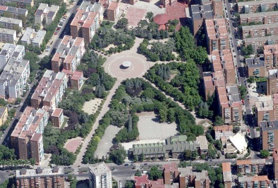
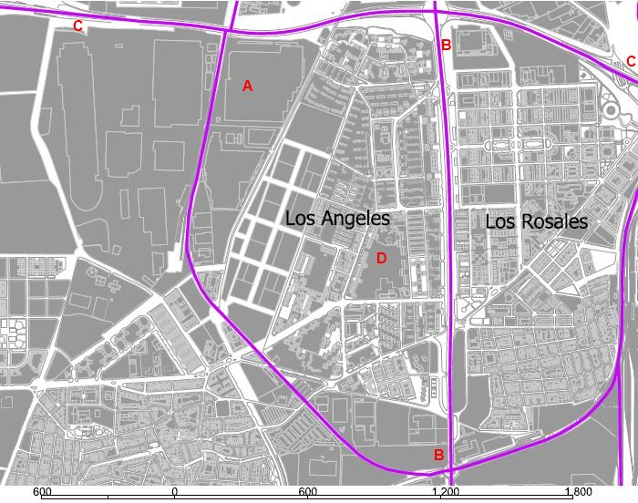
Ciudad de Los Angeles is representative of the urban growth in southern Madrid during the boom economics of the 1960s and 1970s. The area grew due to employment in the automotive industries (A) and other industrial and military activities, taking advantage of its location by the trunk highway to Andalucia (B-B) and the presence of railways. More recently, the area has been subject to the presence of the M-40 orbital freeway (C-C). The central park (D) is the most relevant open space. The density of the Barrio is “artificially” low as compared to its built form, as the old industrial and military compounds, in many cases already vacant, are into the administrative boundary.
Recent growth has been testimonial as the area is not considered atractive on the metropolitan scene. The housing units have energy efficiency and material quality problems, so the area has been declared the first integral rehabilitation district in Madrid out of the historical core.
As earlier mentioned, density here can be misleading: not taking into acount the old industrial compounds, it would rise to some 120 dwellings per hectare, over that of Vigny- Musset in Grenoble sud (page 180 on Habitat-formes urbaines)
The most common dwelling size range in 2001 was 76 to 90 sq m.
Get a more detailed look at the area through google maps


Leave a comment