The island of Manhattan has been repeatedly described. In this case I would choose the proposals in the book “The Iconography of Manhattan Island 1498-1909”, by Stokes, Paltsits and Wieder, that you can download from http://archive.org/details/iconographyofman06stok (note this is a 73,5 Mb download). The content is not limited to maps, but there is also an interesting collection of historical vistas that illustrate the evolution of the urban fabric. I would choose two images:
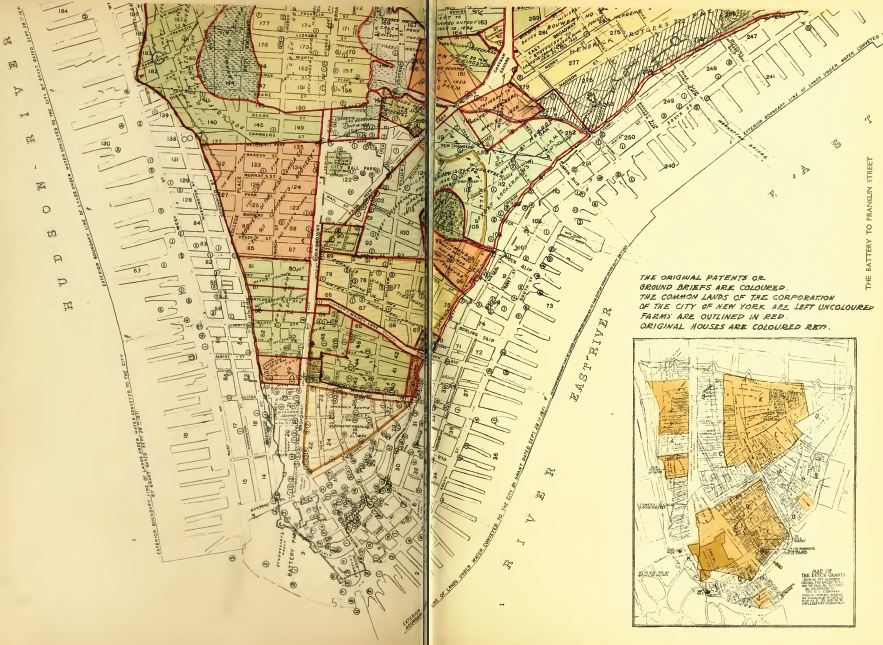
The map of the original patents or ground briefs, with the farms outlined, on the southern point of Manhattan, what is today known as wall street.
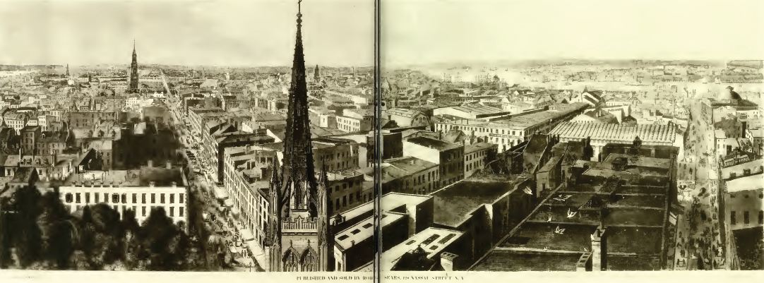
The view from the roof of Trinity Church in 1848, which shows a city that is still European for heights and general layout.


Leave a comment