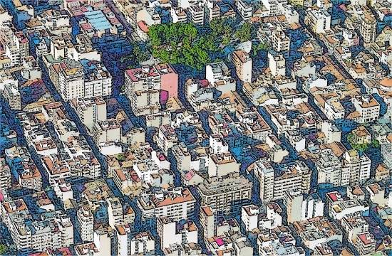
The images in this post correspond to a Spanish city; but I will not say which one, as this is not relevant; in a certain way, it could be anywhere in the world, as urban tissues evolve over time, as it is so well explained in the Biblio post of this week.
The extension grid, conceived in a given moment for a height and a building type (here individual homes on two heights, with a lot courtyard on each and reduced dimensions) is substantially densified through the use of multifamily housing, bigger lots (everyone wants his parking slot to be in the building) and with 3 times the original height. As the city block is narrow, no central courtyard was present and none is expected to appear now with such densities. Double aspect apartments are also far from possible, and in general the housing units are far from optimal. But this density allows a feasible retail base in the buildings, a chance to walk to work, or other advantages of density. Take two more elements: the city is an organism with a substantial inertia, as buildings can easily stay for 50 or 100 years, and the urban planning rules can change several times over that period, so chances are you will never see all the buildings in the block with the same height…

So we face an urban landscape whose plan view can be regular, but in which separative walls between lots and height differences can be not temporary, but permanent features; a cartoon artist, Ibañez, always rendered as a background images with these height changes and fractured skylines so common in the Spanish cities of the last century. But this is not exclusive of Spain: if you are in Paris, some areas as the southern XVth district show well the brutal stop to “business as usual” that WWI meant, with city blocks in which changes in height and regulation are clearly visible…


Leave a comment