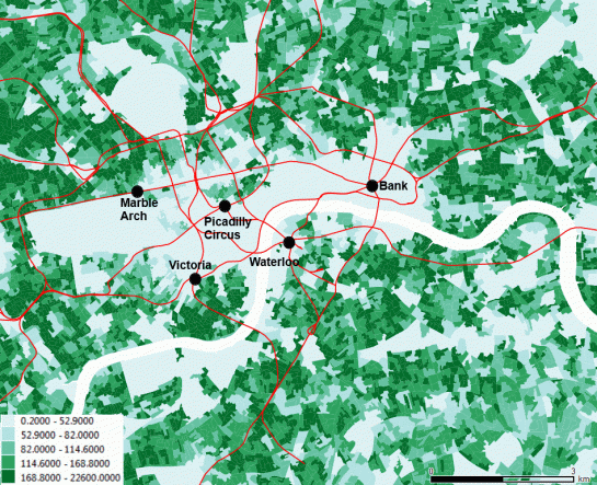
Is London a dense city? Well, related to what?. The map represents the population density (persons per hectare, UK Census 2011); it is striking to see that the scenic central London, seen by tourists, is a sort of void. The red lines are tube lines, and the names are those of some stations.
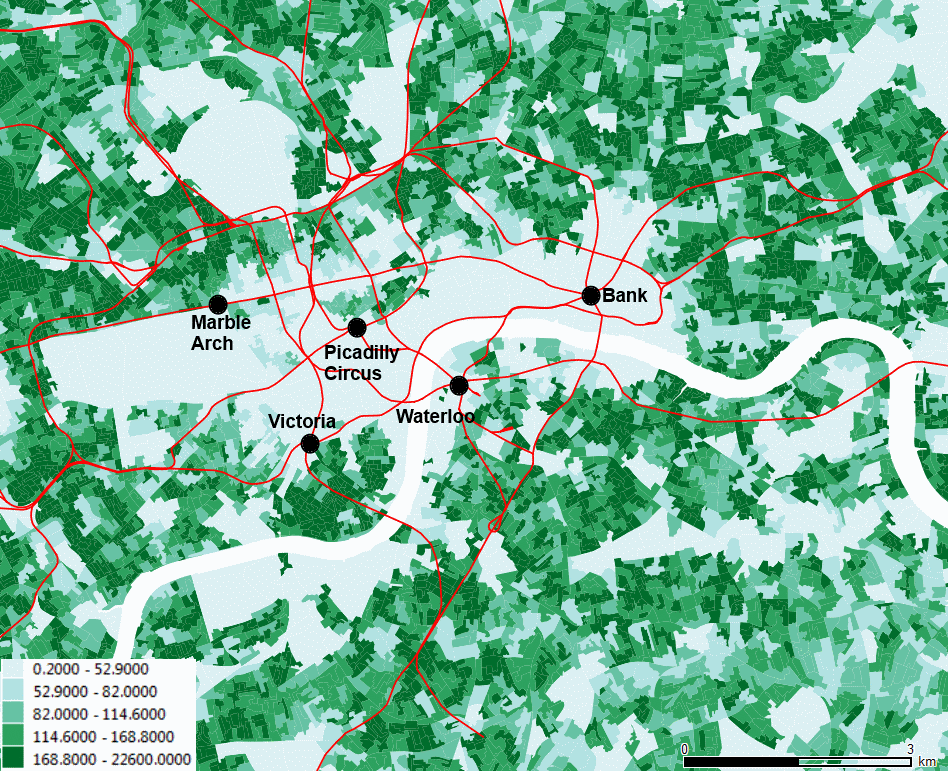
Is London a dense city? Well, related to what?. The map represents the population density (persons per hectare, UK Census 2011); it is striking to see that the scenic central London, seen by tourists, is a sort of void. The red lines are tube lines, and the names are those of some stations.
51.511214
-0.119824


Leave a comment