Planning is somehow a narrative thing: you have to create a story that can be of interest to your audience, as to make sure they can become involved in a project that, finally, is theirs as they are the ones living there. But it can become a narrative on its own, or just a way to rediscover a space you have known for a long time, just by getting conscious of features are not aparent every day. And this is clear when you talk about large scale planning.
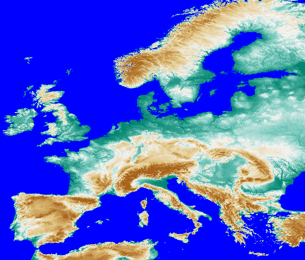
I once read “The stone raft”, by the portuguese Nobel writer José Saramago, a book in which the Iberian Penninsula gets cut from Europe following precisely the political borders to go for walk around the Atlantic: the Pyrennées get sharply cut along the border line, and in a given moment Andalusians flock to Malaga to see Gibraltar Rock pass along, as it keeps in its original place (well, that also happened somehow in “Hector Servadac” by Jules Verne). So I decided to think about a less violent cut (sort of…). I downloaded SRTM elevation data for the Iberian Penninsula and Europe-wide data from the European Environmental Agency. If the whole world was to see a rise in the sea level of 200 m (for whatever reason, be it climate change -whose forecasts are way inferior to this figure- or any other you can think of), the whole of Iberia would be an island… albeit a quite different in outline from what we know now.

Being coherent, this hypethesis means most of Europe would get under the sea. The Netherlands and Denmark would be mere memories, Paris, London, Berlin and Rome would also be under water, the Ruhr valley would be a great lake and most of Hungary would be a large bay.
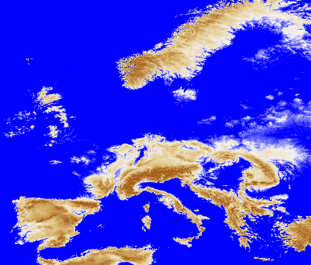 Spain, Switzerland and Austria would be the countries in the least bad situation, as most of their territory would be untouched. What is under the 200 m contour?


Leave a comment