metrhispanic
Français
Español
About Javier Barros and this blog
Biblio- selected readings
contact
Tag:
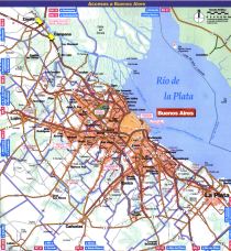
Buenos Aires
Latin America cities
Bibilio (118) Urban retail at Buenos Aires and Bogotá
Cities
,
Neigborhoods
Biblio (46) The precarious settlement planning handbook
Latin America cities
,
Spanish cities
Madrid-Buenos Aires (5)
Latin America cities
,
Spanish cities
Madrid, Buenos Aires (4)
Latin America cities
,
Spanish cities
Madrid, Buenos Aires (3)
Latin America cities
,
Spanish cities
Madrid, Buenos Aires (2)
Latin America cities
,
Spanish cities
Madrid, Buenos Aires (1)
Latin America cities
,
Spanish cities
Biblio (28) A tale of two cities
Cities
Urban planning and food (5). Buenos Aires
Latin America cities
Urban freeways (7). Buenos Aires
Subscribe
Subscribed
metrhispanic
Join 188 other subscribers
Sign me up
Already have a WordPress.com account?
Log in now.
metrhispanic
Subscribe
Subscribed
Sign up
Log in
Report this content
View site in Reader
Manage subscriptions
Collapse this bar