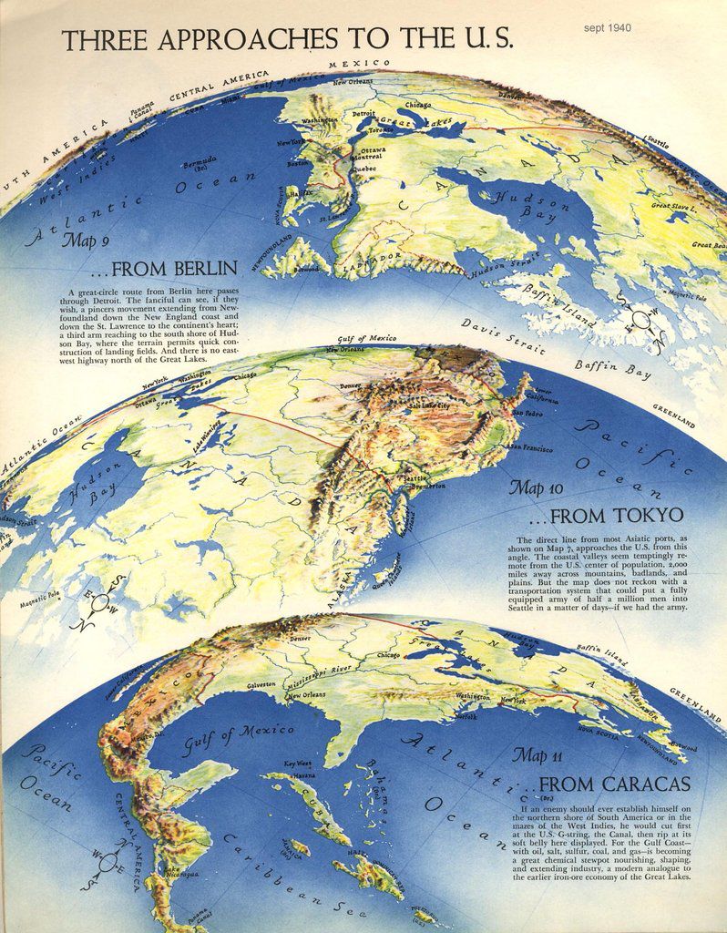
Richard Edes Harrison’s story is interesting: how a designer became a cartographer not because of specific map-making skills, but rather through his ability to convey a complex information to common people. In a moment (WWII) in which aviation was the technology that transformed the perception of distances, his maps introduced to the US public projections and perspectives that, by going ahead of the traditional Mercator projection, allowed people to better understand the events as they unfolded.
Timothy Barney’s and Kenneth Field’s articles are interesting


Leave a comment