Mid-size cities

Industrial traditions (6) Bilbao: some lessons about its transformation

bilbaoria2000

Bilbao Ria 2000, the public company established in 1992 with the presence of several administrations that has directed a substantial share of the urban transformation projects in Bilbao, invested in the city from 1997 to 2011 beyond 957 million euros (slightly above 1,3 billion US dollars), for a metro area not reaching 1 million residents. Its work has touched seven main areas: six neighbourhoods and the urban integration of a rail network that created substantial urban obstacles. These works have clearly improved the urban landscape, as well as the way Bilbao is seen abroad.
Elias Mas Serra, former Head of the Architecture Board of the Bilbao Municipality (1991-2005) published in 2011 in the Bulletin of the Spanish Geographers Association an article about the management of Bilbao Ria 2000. The article is an analysis of a set of public policies that have been successful, but that raise some questions on which to reflect to improve future interventions: the problems derived from the asynchronous production of planning documents at different scales, as well as the need to ensure coherence between local and metropolitan scales in such projects.

Industrial traditions (4) Brownfields

Brownfield location in metropolitan Lille

Brownfield location in metropolitan Lille

Metropolitan Lille concentrates one of the largest sets of brownfields of the whole France. This means as much an urban problem due to the jobs and active urban uses loss in a context in which some areas are like a “sprawl by disappearance”, as an environmental one, due to industrial pollutants in the soil after years of industrial production.
In june 2010 Lille Metropole published a report on these brownfields and their pollution situation. Every aspect is analysed, from the spatial distribution of this problem to the national policies or the foreign experiences (with special interest in Flemish and USA cases), with a proposal of guidelines to tackle the issue from the urban planning scene. It is an interesting publication on a matter concerning more cities than usually expected.

Industrial traditions (1) A sample

Old industrial cities in what we call usually the “western countries” are often an exemple of how hard it is to maintain an economic health on the long term, but also that this is achievable. Monterrey is still a reference in the Mexican industrial landscape. Chattanooga seems to be succeeding its transition to a more viable economic model. Lille tries to reinvent itself as a reference node in the European High Speed Train network, and Bilbao has in fact changed its image thanks to a museum that is, in fact, just the tip of the iceberg.

Biblio (81) Syracuse urban freeway


The article published on the Atlantic Cities magazine (which I read thanks to its reference at salvolomas) shows the antagonic interests at play when it comes to the future of an urban freeway. The balance between impacts and benefits of an infrastructure project, again a central issue in the planning of urban space.

Re-mid-sized cities (1) A sample

A mid-sized city can be such as a result of growth until reaching that status, or it can be the result of a certain downgrading from higher ranks. I am fully aware that some of the things I’m going to say could be unpleasant, but this is a long-term vision, and history is made every day, so nothing is unavoidable.

I’ve chosen four cities that, as in the first case, are seaports, but with quite different roles. They have been high places in the European colonial adventure (that could receive other names in different places). Seville as the main port in the first times of the Spanish empire, Marseilles as the French gate to the African and Asian empires, New Orleans as the gate to the Mississippi Valley, and Havana as the capital of the last jewel of the Spanish empire. These are by no means small cites, and they are rather relevant in their states, as to make many think that I’m not fair saying they are mid-sized cities; but they are no longer cities with a continental reach. They have sure gained population, but have lost rank.

Yet they are very interesting places. How does a city evolve when the technological- economical-social (you name the issue) wave that propelled it to its highest position disappears? The rise of these cities is linked to their network of relations in colonial worlds, and their evolution is related to the fact that new models appear that are more successful. There is a scent of Detroit here…

Far away ports (8) The port is dead, long live the port

puertos int-ext

Think of a complex coastline, which is under the regular impact of strong storms that even in the case of large oil tankers can lead to relatively high shipwreck events. One day comes the tanker whose wreck becomes, for various reasons of diverse coherence, a social threshold, a wreck too many. This happened in Galicia (north-western Spain) in 2002 with the Prestige tanker. As a result, the Spanish government (with powers over large ports) decides to create in La Coruña (b on the upper image) and Ferrol (d) two new large external harbours (a and c). The rationale is to take hazardous traffics off the city centres. Creating new infrastructures is rather common, but here the operation brings to mind what to do with urban core quays. Bilbao managed to conduct such an operation some 10 years ago around the Guggenheim museum.

The new General Plan of La Coruña. Urban extension land is red. The new harbor is on a different municipality.

The new General Plan of La Coruña. Urban extension land is red. The new harbor is on a different municipality.

The new General Plan of La Coruña defines a new residential area over much of what now are quays. The municipality is rather small, and quite occupied by urban areas, so it is a growth option. This will transform what is now an urban core harbour, and seems rather an industrial area, in a different thing, raising questions about how the soul of the city will change. But it also raises questions on how long this will take in a crisis context.

In the middle of this there is a large water surface.

In the middle of this there is a large water surface.

The port transformation proposal

The port transformation proposal


Far away ports (6) Regional planning- Brest

Ports matter as exchange points between exterior ports and the served inland areas. How is this organised in terms of metro area relations in terms of spatial planning?

Portada SCOT

Brest has a regional planning document (SCOT) encompassing the western tip of Brittany and 14 intermunicipal cooperation schemes. The SCOT is relevant for some land use operations over 5 hectares (some 12 acres) and big box retail proposals. Its maps must be adapted by local planning to a larger detail scale. The urban system is organized in urban agglomerations (large population settlements in all the coastal municipalities+ 3 secondary settlements + areas so defined in local plans), villages (over 40 dwellings) and hamlets. Infill growth is priorized (and the only option in hamlets), and higher level settlements can also have continuity growth (no leapfrog growth permitted).

Brest's regional development scheme basic layout: a special relevance is given to the conservation of the coastal band and to the  survival of the traditional farmland. urban growth must follow a set of rules, being directed towards a linear expansion of the main city along the northern shore of the bay

Brest’s regional development scheme basic layout: a special relevance is given to the conservation of the coastal band and to the survival of the traditional farmland. Urban growth must follow a set of rules, being directed towards a linear expansion of the main city along the northern shore of the bay

Transportation is also a relevant issue for Brest's SCOT.

Transportation is also a relevant issue for Brest’s SCOT.

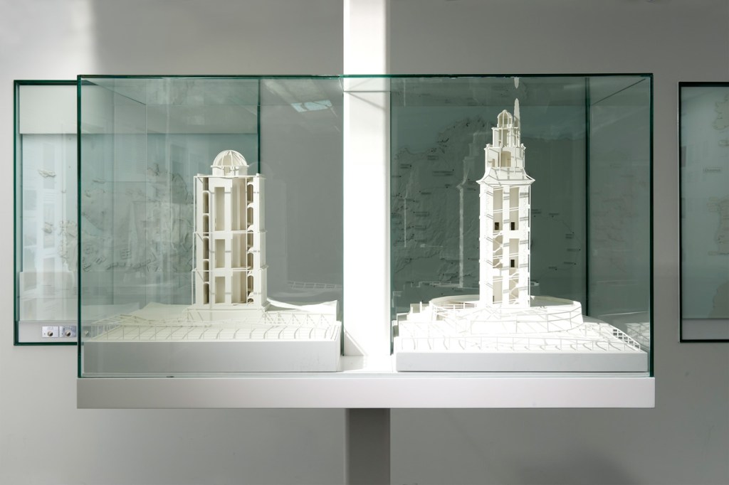
Far away ports (4) Histories. Towers, submarines, beavers, salmons…

La Coruña port existed in roman times. The Hercules Tower, a roman lighthouse which is thought to have been built during the first century AC, shows the relevance of the area during that time. The relevant port of the region was present Betanzos (Brigantium), as its ria was less silted and ships were smaller. During the Middle Ages the city becomes more relevant, and the opening of the American trade after the end of the monopoly of Seville and Cadix helps. Around the mid XXth century the port occupies most of the southern bay, protected by the peninsula; this is the last vision of Spain for thousands of Galicians migrating to America. During the 1960’s a large jetty is built to enlarge he port, and a new oil refining plant gives relevance to liquid bulks. This also leads to several tanker accidents that pollute the air and the ocean. The transition to democracy with the death of Franco brings regional devolution and the loss of the regional capital to Santiago, with the transfer of many public jobs. During the last decade a new port has been built, west of the historic bay, in part to reduce risks (oil wharfs are linked to the refining plant by a pipeline near homes), but the location is clearly into the metro area. The presence in that metro area of the headquarters of Inditex, the textile group owning Zara, helps to a certain degree to weather the current economic crisis.

Brest

Brest is first mentioned in history as a roman encampment at the end of the IIIrd century AC. The estuary of the river Penfeld made for a good natural harbour for the ships of the age. In 1593 Henri IV incorporates Brest as city, and in 1631 Richelieu establishes an arsenal on the Penfeld’s banks. The city plays a relevant role for the fleets helping the United States in their Independence War. The XIXth century starts under the British naval blockade, hurting the port; this changes under the second empire, with a wider sea trade, new rail lines and bridges over the Penfeld. Urban growth goes crosses the historic walls. Bigger ships make the need for a larger port, out of the Penfeld estuary, and new warfes are open on the large bay. During WW2 the port becomes a German Naval base and is bombed by the allies, which destroy a large portion of the city, later rebuilt. The creation of the Oceanic Strategic Force in 1972 leads to the creation of the new nuclear submarines base on Ile Longue, south of the bay. The reduction in military budgets hurts the city.

Duluth

Duluth receives its name from the first European explorer of the area, a XVIIth century French soldier which was called “Sieur du Luth”. The first known residents were the Anishinaabe tribe, which played a mediating role between the French and other Indian nations. Fur trade (especially beaver) was a relevant part of that early trade. In the mid XIXth century cooper mines, new locks allowing the arrival of large ships to lake Superior and plans for new rail linking the city to the Pacific (creating so a inter-ocean port) helped fuel the inception of the city. The port and the city grew exporting ore (mainly iron) and cereals. The crisis of the traditional heavy industry at the end of the XXth century has touched the city, but it is to a certain degree compensated by tourism and services to the metro area.

Puerto Montt in 1861.

Puerto Montt had some population prior to the arrival of the Spanish (southern Chile was never really incorporated to the Empire). Around the mid XIXth century German colonists started arriving to the area, and the city is incorporated in 1853. The rail line to Osorno starts operation in 1912. During the 1930 there is a substantial transformation of the waterfront, with new embankments, rail lines, a wharf and the dredging of the Tenglo channel. The city becomes in 1974 the capital of the Xth region (Los Lagos). Since 1985 the salmon production becomes important (and the plague problems for the species test the local economy), with other more traditional activities as agriculture, cattle or wood being also relevant. Tourism has become a relevant asset too.

Far away ports (3) Contraptions

Those that have never lived in a port city often have no idea on how variable their landscape is. A ship of a certain size can be longer and higher than many buildings, and its skyline can change with the arrival of sizeable volumes of colours that can be quite different from those of the buildings. However, this game is far from being reserved to ships.

Ports are, as cemeteries, areas in which architecture develops along particular lines. On the former, aesthetic rules can be taken far from what is allowed in the city of the living; in ports, what is utilitarian clearly takes control, as well for buildings as for any foreseeable contraption. There are outstanding port buildings, which have outstanding architectures, but most are rather limited in that sense, with multiple additions and improvements that are often without much architectural interest. When you focus on mobile contraptions, especially on freight ports, a world of vehicles, cranes and bridges opens and can easily become surprising.

The new crane (left) and the former, still in use model

The new crane (left) and the former, still in use model

Some days ago, walking by the port of La Coruña, I saw one of the new cranes in motion. Just a few decades ago the former, wood-cabin cranes were substituted by new, higher, steel ones, that as the former moved along railroad tracks. About a decade ago new cranes, a bit higher, moving on tires, were introduced. Seeing one such machine when they go from one wharf to another, moving very slow, is not without reminding the motion picture “Despicable me” and Gru’s car: high, with a permanent air of instability, and in fact seeming a toy… but for its overwhelming weight.

The dome on the left protects some solid bulks from the wind

The dome on the left protects some solid bulks from the wind

On the other side, the machinery for solid bulk, which sometimes can create allergic outbreaks if dispersed through the air, has a clear urban presence.

The Aerial Lift Bridge

The Aerial Lift Bridge

When ports are on busy circulation corridors, the need for bridges appears, and so that for complex solutions. In Duluth the Aerial Lift Bridge is one of the city icons. It was built to grant access to the Minnesota Point peninsula after the opening of a navigation channel through its base. The first years it was a transporter bridge, to be later transformed in the current car bridge with a vertical motion platform that adapts to the air draft of passing ships. Besides, as in many ports in this area of the great lakes, where iron ore is one of the most common bulk freights, the contraptions that allow the transfer of the load from trains to ships are simply impressive (something that can be well perceived on this video about a different port in Michigan http://www.youtube.com/watch?v=rzWwTOt39Es&list=PL7eOOJxsVrlgY0de0Osk7DTF8l2r9ksOb&feature=share&index=3). Such wharfs can only be seen (but not in active) in zones of Spain like Huelva or Almería.

Brest also has a moving bridge at Recouvrance, with a more contemporary structure. It is the main French port for naval repair, so it is common to see many large ships; as a relevant naval station, there are also many other “toys”, but not always visible.

View of Puerto Montt, as seen in the website of the Port Authority (empormontt.cl)

In Puerto Montt the port has less such contraptions; but you can see the Andean volcanoes on the background (something the other three ports can hardly compete with…)

Far away ports (2) Landscape and climate

The landscape of these four cities is marked by the irregular coastline, elevation, geology and vegetation.

Brest sits on top of a coastal cliff some 40 m high which overlooks the bay, with the Penfeld valley (the initial port) as its western limit. There are just a few zones around with heights over 60 m; the coast is marked by cliffs, but not by mountains or characteristic hill profiles. Ravines create valleys that are significant in this landscape.

Duluth is the meeting point for the northern Lake Superior hills and the plains to the south, as well along the Saint Louis river estuary. The city site is on a complex land, with steep slopes of volcanic genesis, something that has not helped street and building construction. The elevation difference from lakeshore to the highest points some 2 km inland is close to 200 m, and has contributed to a rich scenic context, attracting tourists since the 1880s. Ravins flowing into the lake have become natural limits between city zones. A sandbar at the mouth of the Saint Louis river estuary protects the harbour. The city has colonized the lakeshores and the estuary, as well as the hinterland.

La Coruña is on the western edge of the Artabrian gulf, a set of bights that reaches Ferrol to the North. It is a series of limited height hills, but on the areas neighboring the open seas, as on Monte de San Pedro. The city appeared on the eastern point of a peninsula united to the mainland by a narrow sandbar; during the XXth century the city has overflowed the plain areas to go uphill to the south and on the northern parts of the original peninsula. There is an inlet on each side of the peninsula, and the harbour is on the eastern one.

Puerto Montt municipality has some areas to the east with elevations well over 1.000 m, but the city itself is on much lower ground. The port sits on a rather benign slope, that is interrupted by a relevant cliff that gets up to the 100 m contour line. This allows for scenic vistas over the Seno de Roncagua, the large bay which extends to the south the Chilean central valley and separates the shores of the Andes from Chiloé Island. The harbour is on the channel between the mainland and Tenglo island.

The climate of these four cities is quite similar during their summers (Puerto Montt is on the southern hemisphere) ; you hardly get beyond 25 ºC, and rain is rather high. Only Duluth sees snow and freezing cold for several weeks on a row, so it has created a Skyways network.