Here is the coastline I know best. Bathymetric data is still that of the General Bathymetric Chart of the Oceans , by the British Oceanographic Data Center, with depth contours in meters. Contour zero comes from a generalization of the digital elevation model, and it is into the current sea when compared to the real coastline, so I render it to show the precision level of the data source, which is enough given the visible scale.
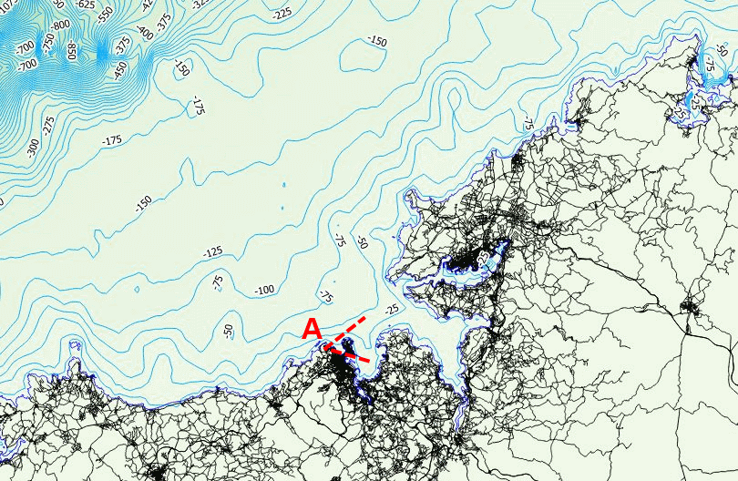
The Galician rias are considered in Spain an example of the way the sea and the land can relate. The sea, but what would happen if the sea were to disappear (an unlikely event) mark the landscape?. Here a substantial part of the landscape that can be seen east of Monte de San Pedro, a belvedere over La Coruña (A on map) would be at a depth lower than Hercules Tower, the Roman lighthouse of the city, inscribed in the UNESCO world heritage list.
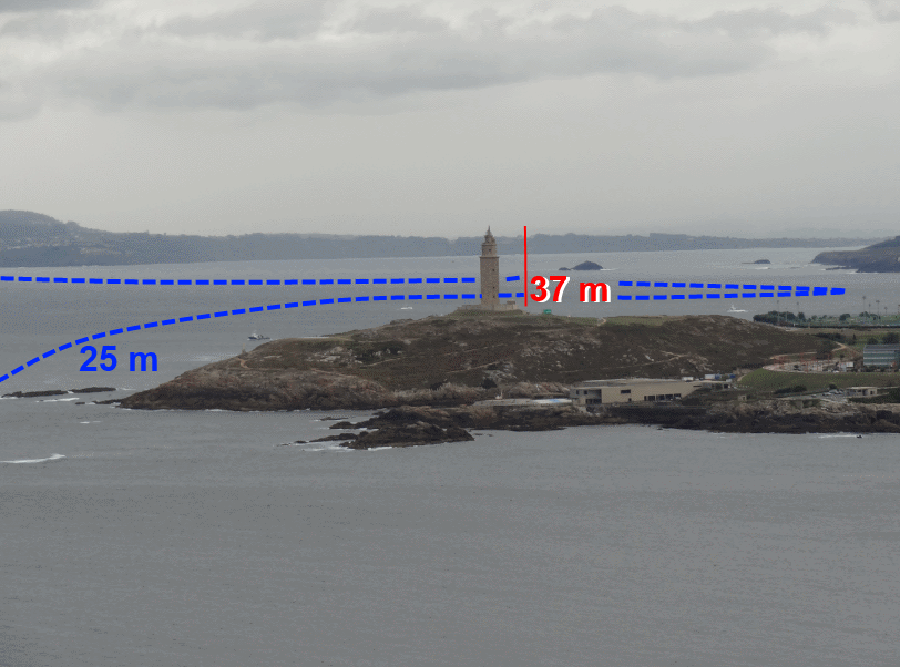
The elevation of the tower over the current sea level is already substantially higher than the surrounding depths. On the image, you can see an approximate rendering of depth 25 m contour, as well as the height of the tower. The landscape of the area would change if the sea receded, but not just due to the absence of water, that unifies the image, as there would also be shipwrecks, rubbish and other signs of the human presence in the city over the centuries.


Leave a comment